Shroton > Hambledon Hill > Page 4
Print booklet:1 2
Walking direction photo: 17 for walk Hambledon Hill, Shroton, Dorset. Walk direction photograph: 18 for walk Hambledon Hill, Shroton, Dorset, South West England.
Walking direction photo: 19 for walk Hambledon Hill, Shroton, Dorset. Walk direction photograph: 20 for walk Hambledon Hill, Shroton, Dorset, South West England.
Walking direction photo: 21 for walk Hambledon Hill, Shroton, Dorset. Walk direction photograph: 22 for walk Hambledon Hill, Shroton, Dorset, South West England.
Walking direction photo: 23 for walk Hambledon Hill, Shroton, Dorset. Walk direction photograph: 24 for walk Hambledon Hill, Shroton, Dorset, South West England.
Previous © J. Ansell 2002-2009 Printing Hints
Shroton > Hambledon Hill > Page 1
Print booklet:1 2

Hambledon Hill, Shroton

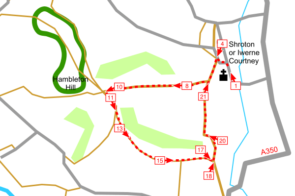
This walk climbs Hambledon Hill from Shroton. It returns to Shroton via a different route. Extend the walk to 4.5 miles or 7.3 Km by walking around the ramparts of the Iron Age fort.

Hambledon Hill is a spectacular archeological site with neolithic enclosures and an Iron Age Fort on the hilltop. It is also a National Nature Reserve, it is an important chalk downland habitat for flowers and butterflies. Allow plenty of time to explore.

Shroton is sign posted off the A350 between Blandford Forum and Shaftesbury. Park on the road in the village. The walk starts from in front of St. Mary's Church.

Map:OS Landranger Sheet 194Grid Ref:ST 859 124
Distance:2.7 miles / 4.4 kmClimb:620 feet / 190 m
Difficulty:ModerateDate:May 2010
Printing Hints © J. Ansell 2002-2009