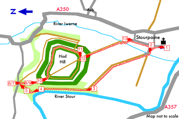
Starting at Stourpaine church this walk follows a track to the River Stour then follows a path through woodland to the road at the north of Hod Hill. Here you will find a small car park and an information board about Hod Hill. The walk returns to the church over the top of Hod Hill for spectacular views of the Stour and Iwerne valleys .
Hod Hill an old Iron Age fort, its ramparts once protected a large village of about 250 round houses. Around 44 AD the Romans captured the earlier village and built their own defences within the iron age fort. Allow time to explore the old forts while at the top of the hill.
The village of Stourpaine is on the A350 between Blandford and Shaftesbury. Park near the church in Stourpaine.