 |
|
|
|
|
|
 |
 |
 |
 |
 |
|
| Click on view to enlarge. |
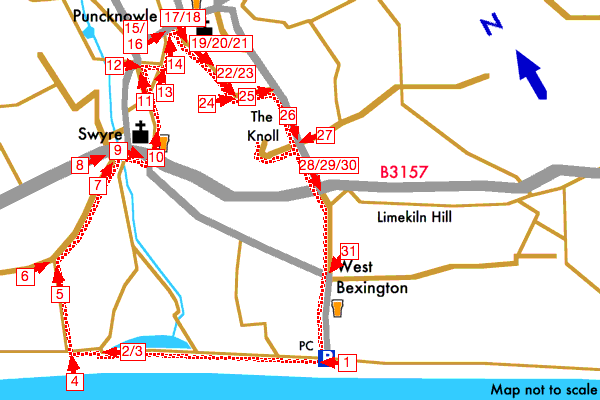
Swyre and Puncknowle, West Bexington, Dorset |
|
|
Starting from the beach car park the walk goes west along the South West Coast Path then turns inland to Swyre. From Swyre the walk then follows a track and footpaths to Puncknowle then returns to West Bexington via The Knoll along minor roads and tracks.
See the detailed walk directions.
The Knoll was once a Customs lookout post for watching for smugglers bringing in contraband from the continent. On a clear day, from here, you can get spectacular views in all directions.
Please check our walk preparation guide.
Find accommodation near this walk with bedsearcher.
|
|
|
|
| Distance: | 4.1 miles / 6.6 km | Date: | May 2006 |
| Climb: | 625 feet / 190 m |
Walk Duration: | 2 hr 10 mins |
| Difficulty: | Moderate | Calories used: | 580 kcals |
|  |
|
|
The arrows on the map show the locations of walk direction pictures.
|