|
|
|
|
|
|
 |
 |
 |
 |
|
|
| Click on view to enlarge. |
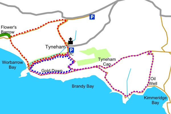
Tyneham - Range Walks, Dorset, South West England
|
|
|
Tyneham was one quiet little village, consisting of a church, school house and a number of cottages, close to the Dorset coast. During November and December 1943 all the residents of Tyneham and the surrounding area were evicted so that the Army could train using live shells. After years of neglect the church and the school house have been restored and are now museums.
Tyneham Village and the Range Walks are part of a Lulworth and Tyneham Defence Training Estate and access is limited, check the opening times. For your own safety keep to the paths.
Follow signposts to Tyneham and the Range Walks from Stoborough Green which is on the A351 Wareham to Swanage road. There is an information notice at the junction to indicate if the range walks are open.
|
|
|
|
|
|
|
|
 |
Parking |
 |
Minor road |
 |
Track |
|
 |
Footpath |
 |
Stream |
 |
Woodland |
|
 |
Church |
 |
Public convenience |
 |
Picture |
|