|
|
|
|
|
|
 |
 |
 |
 |
|
|
| Click on view to enlarge. |
Studland, Dorset, South West England
|
|
|
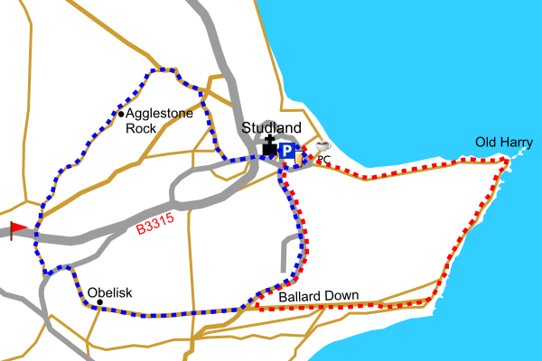
Studland is an attractive Dorset village that was a centre for smugglers in the 18th and 19th centuries. It is now a popular destination for beach and walking holidays. If you would like a longer walk from Studland combine both walks for a total length of 6.4 miles / 10.2 km.
Next to the car park you will find the Bankes Arms where you can refresh yourselves before or after a walk. Alternatively you could try the refreshments at the nearby beach cafe.
Park in the Studland South Beach car park sign posted from the B3351 that goes through the village.
|
|
|
|
|
|
|
|
 |
Parking |
 |
Main road |
 |
Minor road |
|
 |
Track |
 |
Footpath |
 |
Golf course |
|
 |
Public house |
 |
Tea rooms |
 |
Picture |
|