|
|
|
|
|
|
 |
 |
 |
 |
 |
 |
| Click on view to enlarge. |
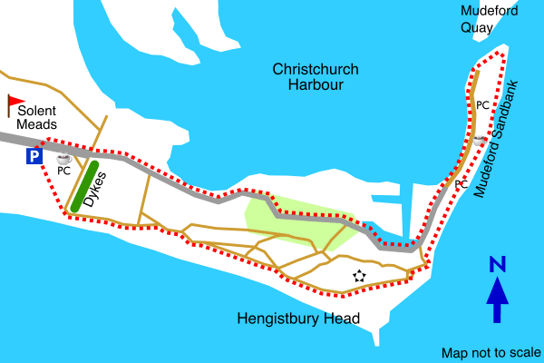
Hengistbury Head is at the eastern end of the Borough of Bournemouth. Poole Bay is to its south and Christchurch Harbour to its North. Excellent views can be seen in all directions from the top of Hengistbury Head.
There is some evidence to indicate that Hengistbury Head was occupied during the Stone Age, through to the Iron Age and during the Roman Occupation of Britain. Hengistbury was used for smuggling towards the end of the 18th century.
Follow signposts to the Solent Meads golf course from the A35, between Christchurch and Bournemouth, close to Christchurch. Then follow signposts to Hengistbury Head and its long stay car park.
|
|
|
|
|
|
|
|
 |
Parking |
 |
Main road |
 |
Minor road |
|
 |
Track |
 |
Footpath |
 |
Ramparts |
|
 |
Tea rooms |
 |
Tumulus |
 |
Woodland |
|
 |
Picture |
 |
Two pictures |
|
|
|