 |
|
|
|
|
|
 |
 |
 |
 |
 |
|
| Click on view to enlarge. |
Compton Abbas, Fontmell, Dorset |
|
|
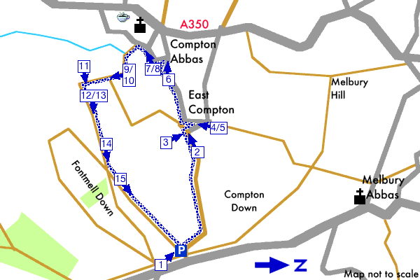
This walk starts from the small Fontmell car park by following a track down the side of Compton Down to the village of East Compton then follows a quiet road to Compton Abbas. The walk returns to the car park via a footpath up the side of Compton Down.
See the detailed walk directions.
Please check our walk preparation guide.
Find accommodation near this walk with bedsearcher.
|
|
|
|
| Distance: | 2.4 miles / 3.9 km | Date: | Apr 2004 |
| Climb: | 475 feet / 144 m |
Walk Duration: | 1 hr 20 mins |
| Difficulty: | Moderate | Calories used: | 360 kcals |
|  |
|
|
The arrows on the map show the locations of walk direction pictures.
|