![](../../common/transpix.gif) |
![Click on view to enlarge.](s_images/B1.jpg) |
![Click on view to enlarge.](s_images/B2.jpg) |
![Click on view to enlarge.](s_images/B3.jpg) |
![Click on view to enlarge.](s_images/B4.jpg) |
|
|
Click on view to enlarge. |
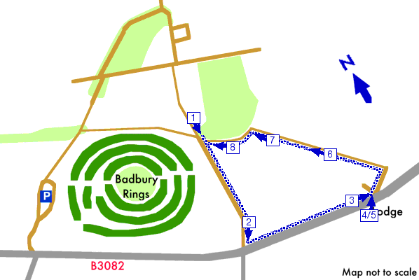
East of the Rings, Badbury Rings, Dorset |
![](../../common/transpix.gif) |
|
Starting at picture 11 of the red walk, this is a circular extension to the red walk as far as the Kingston Lacy Lodge, it returns along a path through farmland.
See the detailed walk directions.
Please check our walk preparation guide.
![](../../common/transpix.gif) |
Distance: | 2.1 miles / 3.4 km | Date: | Oct 2002 |
Climb: | 200 feet / 60 m |
Walk Duration: | 1 hr 5 mins |
Difficulty: | Moderate | Calories used: | 270 kcals |
| ![](../../common/blue_walk.gif) |
![](../../common/transpix.gif) |
The arrows on the map show the locations of walk direction pictures.
|